

UTC –:–:–Local –:–
Radio & digital
Propagation, gray line, and digital-mode frequencies for working the world from Northeast Ohio.
Checking the bands…
Propagation now
Maximum usable frequency (KC2G, live ionosonde map)
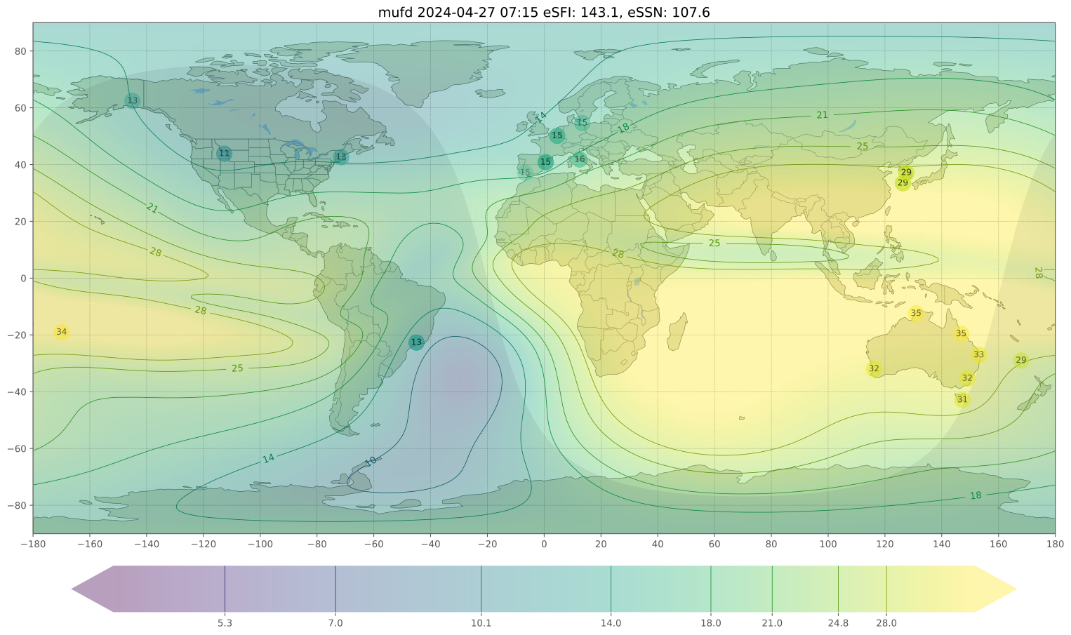
Contours show the highest frequency that will bounce 3,000 km. If your spot reads 21, bands up to 15 m are open.
HF band outlook
| Band | Day | Night |
|---|---|---|
| Waiting for solar data… | ||
- Solar flux
- –
- K-index
- –
- X-ray
- –
Estimated from SFI and Kp.
N0NBH solar-terrestrial panel

HF absorption (D-RAP)

Red areas swallow HF signals, usually after a strong flare on the sunlit side.
Gray line
Day, night and the terminator right now
Sun overheadGray lineK8SCSDX targets
| DX target | Local time | Sun there | Path now |
|---|
Digital mode frequencies
USB dial frequencies, MHz. Tap a frequency to copy it.
| Band | Dial | Outlook now |
|---|
Bands highlighted in green look open right now. Tap the card for PSKReporter’s live map.
See who’s on the air
PSKReporter
Live map
Where FT8, FT4 and other digital signals are being received, worldwide, minute by minute.
WSPRnet
Beacons
Milliwatt beacons mapping band openings, great for testing an antenna.
DX Maps
Spots
Real-time DX cluster spots on a map, including VHF and 6 m openings.
AMSAT satellite status
Birds
Which amateur satellites are working, and reports from recent passes.
Live activity
On the air now
Parks and Summits on the Air activations happening right now, worldwide or filtered to North America, plus any active NWS alerts for Ohio.
Getting licensed
Technician
Study guides, exams and how to find a testing session near you.